 Photo Courtesy: India Today Group
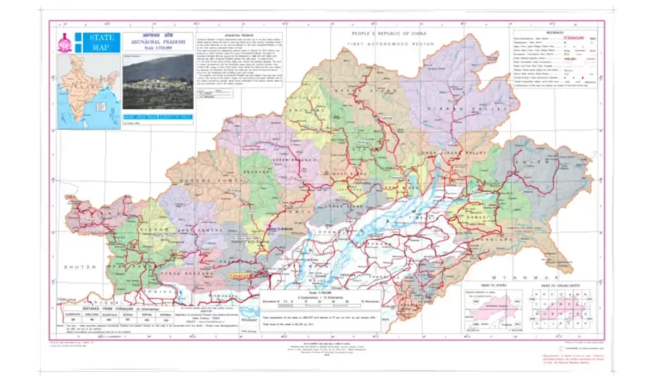
Itanagar: The Indian government has formally standardized 27 locations in Arunachal Pradesh on official Survey of India maps. This move follows Beijing’s repeated attempts to rename areas in the border state. New Delhi dismissed China’s naming claims as baseless and fictitious.
The Press Information Bureau confirmed the initiative on Friday. It aims to improve administrative clarity and public recognition. The list includes land areas, a lake, a monument, and high-altitude mountain passes.
Key sites include Longju, located along the Line of Actual Control and the site of a 1959 border clash. Officials also added Maja in Upper Subansiri district. The list covers Bisa, Dzo La, Riza La, Pukur La, and Thag La. Thag La holds historical weight as the site of an opening battle during the 1962 India-China war. Jairampur in Changlang district, a vital logistics hub for security forces near the Myanmar border, also appears on the map.
Other locations identified are Sambho Sarovar, Bara Kundun, Chhota Kundun, Dhan Bari, Pritnagar, Buddhamandir, Teritnagar, Ramnagar, Jaswant Garh, Sagar, Padma, Jyotinagar, and Baisakhi. The Sher-e-Thapa Memorial stands for 1962 war hero Trilok Singh Thapa. Additional sites include Chhota Ropuk, Bara Ropuk, Shivaji Nagar, Sunpura, and Kamlang Nagar near the Kamlang Wildlife Sanctuary.
Beijing has issued several lists of Chinese names for what it calls Zangnan since 2017. New Delhi rejects these efforts. The official statement declared: "Identifying them formally on the Survey of India map of Arunachal Pradesh is aimed at facilitating their accurate recognition and better awareness among the public at large." India maintains its stance that the region remains an integral part of the country.






Comments