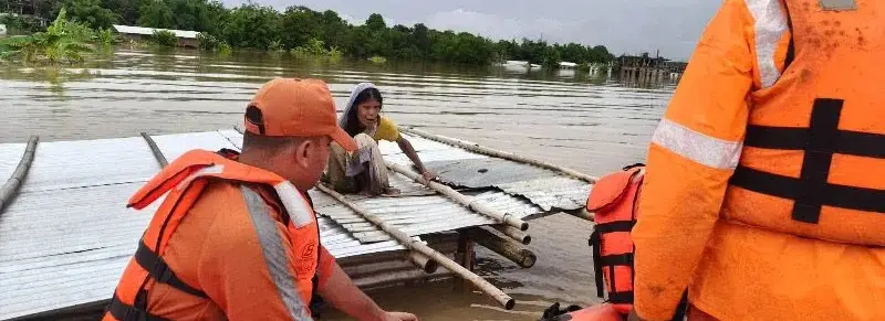
 Photo Courtesy: nenow
Guwahati: The flood death toll in Assam climbed to 66 after four more fatalities were confirmed, according to the Assam State Disaster Management Authority. Three deaths occurred in Sivasagar and one in Charaideo. Despite minor improvements, over 6.54 lakh people remain affected across six districts.
Floodwaters currently inundate 810 villages and damage 34,970 hectares of cropland. Sivasagar remains the worst-hit area, reporting nearly 2.9 lakh affected residents. Charaideo and Jorhat follow with 1.9 lakh and 1.3 lakh people respectively. Officials are operating 274 relief camps, providing shelter to 18,902 displaced individuals. Public infrastructure, including roads and bridges, sustained heavy damage.
A recent surge of water from the Naga Hills into Upper Assam exposed severe gaps in disaster response. A torrent of water covered the distance in only 90 minutes, leaving little time for warnings. While early reports blamed a cloudburst in Nagaland, meteorological data shows the event did not meet technical criteria. Rainfall accumulated over nine hours rather than one. The India Meteorological Department noted that while rainfall reached 137 mm in Nagaland, it occurred too steadily to qualify as a cloudburst.
Warning systems moved too slowly. Administrative procedures stalled the flow of vital information. The Central Water Commission, the Flash Flood Guidance System, and the Flood Early Warning System all failed to provide timely notice to vulnerable populations. By the time alerts were processed, the Dorika River embankment had already breached.
Rebuilding the damaged infrastructure and restoring livelihoods will likely cost Rs 1,000 crore and take up to two years. Analysts argue that current technology is insufficient without automation. Experts maintain that "the tragedy demonstrates that investments in forecasting infrastructure alone are insufficient unless they are integrated with fully automated, real-time warning systems capable of reaching vulnerable communities within minutes."
Proposed upgrades include deploying Doppler Weather Radars, adding telemetry-enabled rain gauges, and linking upstream sensors directly to the National Disaster Management Authority's alert platform. Until these changes occur, rapid-onset floods will continue to bypass existing safety nets.






Comments