 Photo Courtesy: nenow
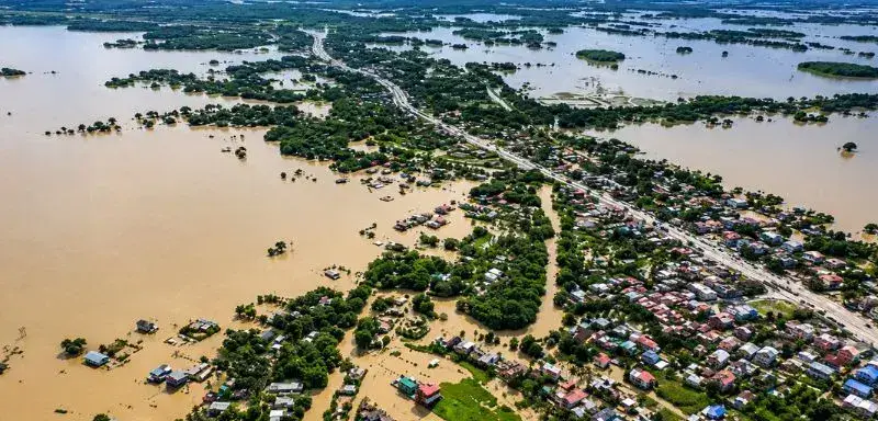
Guwahati: Devastating floods in Upper Assam have claimed over 80 lives and displaced more than 700,000 people across 800 villages and 11 districts. While officials initially blamed a cloudburst in the Naga Hills, the India Meteorological Department confirmed no such event occurred. Allegations surfaced that the Dikhu Hydroelectric Project released excess water, but the project remains incomplete with its three 62 MW units non-operational due to land disputes.
The catastrophe stems from a century of environmental degradation in the Naga Hills. Coal mining, hill cutting, and riverbed stone extraction have destroyed the region's natural ability to absorb rainfall. In the Mon district, underground rat-hole mining and open-cast methods dump debris onto slopes, while roughly 300 trucks move coal and stone through Naginimora daily. This activity continues despite the National Green Tribunal's 2014 ban on rat-hole mining.
Hydrologists, including Professor Arup Kumar Sarma of IIT Guwahati, warn that infrastructure projects like roads and railways are choking river systems with sediment. "Developmental activities like building roads or other infrastructures cutting down a lot of trees for mining or other work in hilly areas if done without a full study of how water moves and without taking care to grow more plants can change the flood situation a lot downstream especially when there is heavy rain in the hills that causes a lot of water and dirt to flow," Sarma said.
Former MLA Debabrata Saikia, who filed a 2019 public interest litigation against illegal sand mining, blames the industry for the destruction of villages like Bihubar, Ramani, and Simaluguri. Reports indicate 18 embankment breaches occurred between April 29 and July 6, followed by six more in Jorhat alone after July 17. The lack of a piedmont buffer in the hills means water reaches the plains within hours, creating saturation-excess floods.
Experts are calling for an integrated disaster committee involving academic, reservoir, and district authorities. They advocate for sensor-based hydrological modelling and ecological management to replace current development practices. Without shifting from this model, observers warn that the price for such widespread environmental disruption will continue to be paid by residents in the plains.





Comments