
 Photo Courtesy: nenow
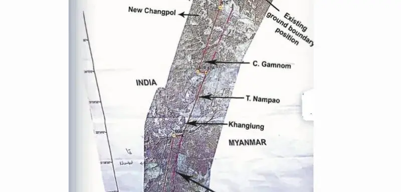
Imphal: A boundary shift in Manipur's Chandel district threatens to hand 1.4 square miles of Indian territory to Myanmar. The proposed realignment sits between border pillars 65 and 68 along a 2.8-km stretch near the Sagaing Region. It puts local villages directly in the line of fire. Residents in Molcham, Khengjang, Yangoulen, Khongkot, Changpol, New Changpol, SL Changpol, and Joldam face total displacement.
The central government wants to seal the 1,643-km border to stop insurgents, traffickers, and illegal migrants. Official documents show the proposed adjustment cuts three kilometers into the area, effectively swallowing these settlements. Residents now fear for their homes. Some expect to end up on the wrong side of the international line. Others anticipate forced relocation deeper into India.
The Ministry of External Affairs confirmed they are holding ongoing diplomatic talks regarding these disputed sections. The agency stated these efforts are part of their broader, official engagement under India's Act East policy. However, local pushback is mounting rapidly.
Groups like the Coordinating Committee on Manipur Integrity and various Kuki organizations are fighting the move. They want full transparency and direct consultation with the people involved. These stakeholders demand the state government provide clear socio-economic safeguards before any surveyor touches the dirt.


Comments