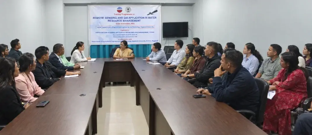
 Photo Courtesy: nagalandpost
Kohima: Twenty-five government officers started a three-day training course on October 6 at the Nagaland University campus in Kohima. The program focuses on remote sensing and GIS applications for managing water resources. The North Eastern Regional Institute of Water and Land Management, based in Tezpur, Assam, organized the event with the Ministry of Jal Shakti and the local Department of Agricultural Engineering and Technology.
Prof. Sujata Dash, the Dean of the School of Engineering and Technology at Nagaland University, opened the session. Assistant Professor Dr. Pramod Dihingia also joined the proceedings. The goal is to sharpen technical skills. The training aims to build capacity of state government officers in use of modern geospatial tools and techniques.
Participants come from five state departments and allied groups, including the Water Resources Department, the Department of Forest and Climate Change, and the Nagaland GIS and Remote Sensing Centre. Others include staff from the Krishi Vigyan Kendra in Kohima, the Working Plan Division, the Department of Horticulture, and university faculty. Trainers Dr. Luna Moni Das, Dr. L. Chitrasen, Bhaskar Jyoti Buragohain, and Shuvajit Das led the day one workshops. They covered geo-databases, basic hydrology, and practical QGIS exercises.


Comments