 Photo Courtesy: nagalandpost
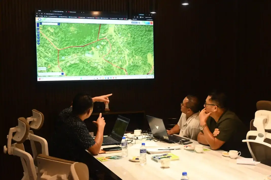
Kohima: The Nagaland GIS and Remote Sensing Centre hosted a technical workshop for the Directorate of Census Operations this week. The state centre manages over 350 map layers, including georeferenced urban and village data. Senior Project Director Mhathung Kithan told attendees that advanced mapping tools and UAV imagery provide the precision needed for modern census counts.
Kithan added that the A+ rated facility expects to secure a license as a drone pilot training institute soon. During the visit, officials toured the Drone Centre of Excellence. They saw 3D printing of drone parts and assembly units in action.
Assistant Director of Census Operations, Mhathung, reviewed the digital census process. He confirmed that his department needs heavy technical backing from the centre. He stated, "The department would require significant technical support from the Centre in the coming months."
Technical staff presented database overviews and project histories throughout the session. Both groups discussed AI applications for spatial analysis and rural mapping. They plan to keep working together on upcoming projects.

Comments