 Photo Courtesy: northeasttoday
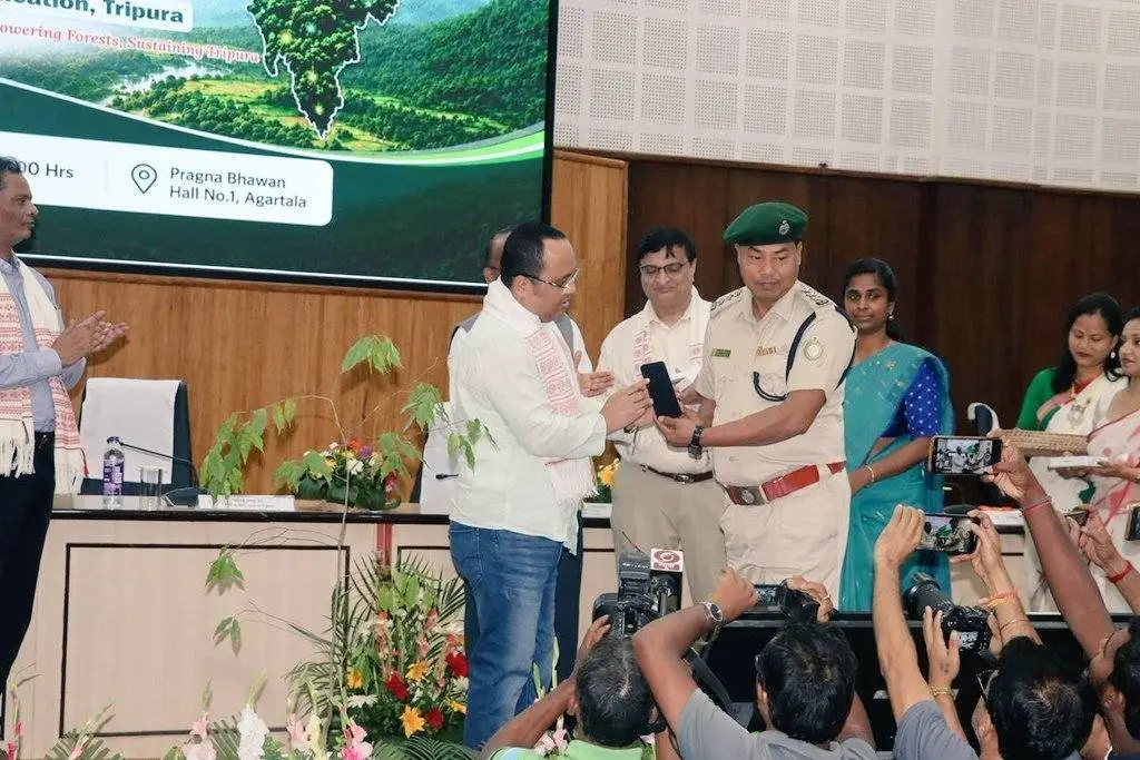
Agartala: The Tripura Forest Department has officially launched the Forestry Integrated Geospatial Solution, a digital platform designed to improve natural resource management and forest governance. Forests, Science and Technology Minister Animesh Debbarma inaugurated the system at an event held at Pragna Bhawan in Agartala. The project is part of the Tripura JICA Project, also known as SCATFORM.
During the launch, Minister Debbarma emphasized that integrating modern technology with conservation efforts is vital for sustainable development. The new platform utilizes satellite monitoring, GIS mapping, and drones to provide a digital dashboard for real-time decision-making. Officials believe this transition to data-driven management will help the state better monitor plantations, water conservation structures, and forest assets.
The government distributed 300 mobile devices to field staff and project officials to assist with geo-tagging and data collection. By analyzing local geography and resource availability, the platform aims to create more effective livelihood planning for the communities that depend on Tripura’s forests, which cover nearly 70 percent of the state.
The event also served to recognize the achievements of the project team. Authorities presented awards to top-performing districts and officers for their contributions to the initiative. Additionally, the department released four new publications detailing the impact of the Tripura JICA Project and honored Santanu Chakraborty of Neo Geo Info Tech Ltd. for his role in developing the FIGS technology.


Comments