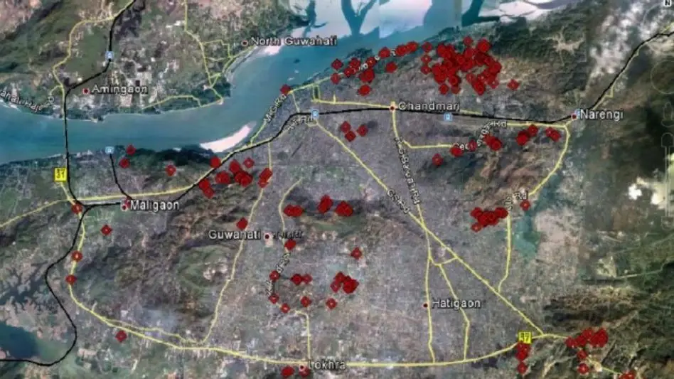
 Photo Courtesy: India Today Group
Guwahati: A recent survey of 366 landslide-vulnerable sites across Guwahati reveals that human activity is the primary cause of slope instability in the city. The findings indicate that 95 per cent of these risks stem from man-made factors such as hill cutting, construction on steep slopes, and inadequate drainage. Only 5 per cent of the identified danger zones are attributed to natural causes.
The study spanned 20 areas, identifying Kharguli as the most vulnerable location with 77 sites. Other areas including Noonmati, Narengi, Khanapara, Maligaon, and Jalukbari-Lankeswar also reported high concentrations of hazard zones. Researchers noted that nearly half of these slopes lack any vegetation cover, which significantly increases the risk of erosion and failure.
Experts have mapped these zones using Google Earth to assist local authorities in disaster preparedness and future urban planning. The report emphasizes that 74 per cent of the surveyed locations require immediate intervention. According to the study, these findings underscore the "urgent need for stricter regulation of hill cutting, improved drainage infrastructure, afforestation programmes and scientific land-use planning" to mitigate risks in Assam’s largest city.
Analysis of the terrain shows that most vulnerable slopes consist of a mix of soil and rock. With the majority of these sites featuring steep inclinations, the report highlights the critical necessity of changing how the city manages its fragile hill ecosystem to prevent potential loss of life and property.







Comments